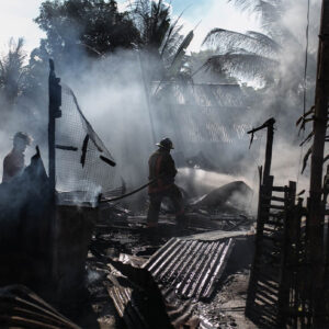
Location-specific disaster risk assessment refers to the systematic evaluation of the likelihood and potential impact of disasters in a defined geographic area—such as a city, region, or country. The goal is to understand the unique hazards, vulnerabilities, and capacities associated with that location in order to guide disaster preparedness, urban planning, infrastructure development, and policy-making.
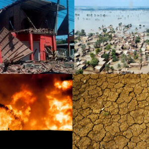
Hazard Assessment: Identifying natural or human-made hazards (e.g., earthquakes, floods, industrial accidents) in a given area.
Vulnerability Assessment: Determining how exposed populations, infrastructure, and ecosystems are to those hazards.
Capacity Assessment: Evaluating the ability of institutions and communities to respond to and recover from disasters.
Location- specific disaster risk assessment
Disaster risk is not uniform—it varies significantly across different geographic regions due to a combination of environmental, socio-economic, and infrastructural factors. A Location-Specific Disaster Risk Assessment (LSDRA) is a focused evaluation of disaster risks within a defined area such as a city, province, region, or ecosystem. It aims to provide detailed insights into localized hazards, vulnerabilities, and coping capacities to enable targeted interventions for disaster preparedness, mitigation, and climate-resilient development. This approach is increasingly important in a world where urbanization, environmental degradation, and climate change intensify the frequency and impact of disasters. By tailoring risk assessments to the local context.
Identifying and characterizing local hazards
Mapping vulnerable populations, infrastructure, and ecosystems
How AI Is Used in Disaster Risk Identification
Predictive Analytics
AI models analyze historical and real-time data to predict future disasters. For instance:
Earthquake prediction through seismic data analysis.
Flood forecasting using rainfall, river level, and terrain data.
Satellite and Remote Sensing Data
AI can process images from satellites and drones to detect early signs of:
Landslides
Flooding
Benefits of AI in Disaster Risk Identification
Speed: Processes data faster than traditional methods.
Accuracy: Identifies complex patterns for better predictions.
Automation: Reduces human workload in monitoring and assessment.
Scalability: Can be used across different disaster types and regions.
Data Quality: Inaccurate or insufficient data can lead to poor predictions.
Algorithm Bias: AI may reinforce existing inequalities if trained on biased data.